")


Introduction:
The Visible Geography Behind Invisible Wars
“Satellites may spy from the heavens, and malware may cripple nations silently, but tank battalions still roll on roads, and oil still flows through chokepoints.”
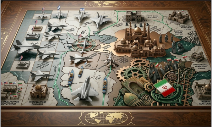
This statement has never been more relevant than during the Iran–Israel conflict of 2025. On June 13, Israel launched a surprise offensive targeting key Iranian nuclear and military installations, including sites in Natanz, Parchin, and Isfahan. The operation, part of the broader spillover from the Gaza conflict, marked a dramatic escalation in a shadow war that had long simmered beneath the surface.
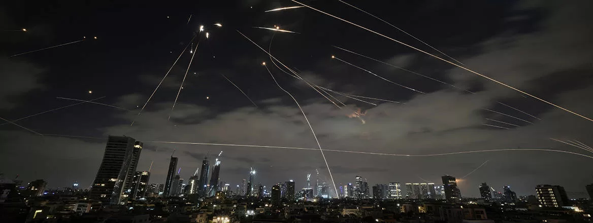
Iran’s counterstrike was equally significant. Using precision-guided missiles and Shahed-136 drones, Iran targeted Israeli military installations such as Negev-based airbases, radar command stations, and logistics hubs. While Israel’s air defense systems, including David’s Sling and Iron Dome, intercepted nearly 85% of these threats, the conflict revealed something more enduring: geography still determines the tempo, reach, and consequences of modern warfare. Despite technological decentralization through cyber and hybrid tactics, it was the terrain chokepoints, bases, and borders that framed the war’s logic. The 2025 war proved that strategy is still written on maps.
Iran’s Strategic Depth and Geographic Leverage
Iran’s geography offers a natural shield and a springboard for influence. Surrounded by seven states, bordered by the Caspian Sea to the north and the Persian Gulf to the south, and with over 2,000 kilometers of coastline, Iran commands an advantageous centrality. Crucially, it flanks the Strait of Hormuz, one of the world’s most vital maritime arteries. According to the U.S. Energy Information Administration (EIA), nearly 20.1 million barrels per day of oil, over 25% of all seaborne oil and nearly 20% of global consumption passed through Hormuz in Q1 2025. The Strait, barely 50 kilometers wide at its narrowest point, became a pressure point when Iranian IRGC Navy units mobilized small boat swarms and placed mines in early June, triggering spikes in Brent crude prices.
Iran’s deterrence posture hinges on what General Kenneth McKenzie called a “corridor of influence from Tehran to Beirut.” This includes Hezbollah in Lebanon, the Houthis in Yemen, and Hashd al-Shaabi in Iraq. Iran’s forward defense doctrine neutralizes geographic encirclement by exporting deterrence outward. Ballistic platforms like the Fateh-110 and Khaibar missiles, coupled with the Shahed drone fleet, cover a radius exceeding 2,000 km, placing Israeli, Gulf, and U.S. regional assets under constant strategic tension.
US-Israel Military Architecture: Geography of Surveillance and Deterrence
While Iran exercises asymmetrical reach, the United States and Israel rely on a vast military footprint known as the “Arc of Surveillance.” Key Israeli installations Nevatim, Palmachim, and Ramon Air Bases formed the launchpads for the June 13 airstrikes. These bases also housed F-35I Adirs and UAV squadrons which carried out deep penetrations into Iranian airspace.
Offshore, Israeli submarines armed with Popeye Turbo missiles cruised beneath the Mediterranean, maintaining second-strike capabilities. Meanwhile, Al-Udeid Air Base in Qatar, home to over 10,000 U.S. personnel, was placed on high alert, supporting ISR (Intelligence, Surveillance, Reconnaissance) operations over Hormuz.
Other critical American assets included NSA Bahrain (headquarters of the 5th Fleet), Ain al-Asad (Iraq), and Al-Tanf (Syria). These bases facilitated real-time intelligence sharing with Israeli forces and monitored Iranian proxy movements. As Robert Kaplan once wrote, “Geography is destiny, but basing rights are power.”
Military architecture in this conflict was not just for deterrence but for signaling. The U.S. deployed additional THAAD systems to Saudi Arabia and reinforced Jordanian radar corridors to ensure early warning coverage. Despite digital surveillance, physical geography remained the foundation for power projection.
Strait of Hormuz and Bab el-Mandeb: Strategic Chokepoints in Action
The 2025 conflict brought renewed attention to the Strait of Hormuz and Bab el-Mandeb, both transformed from theoretical pressure points to active geopolitical flashpoints.Following Israel’s initial airstrikes, Iranian military exercises near Hormuz disrupted the flow of oil tankers for over 48 hours. Insurance premiums surged by 40%, and oil prices climbed from $82 to $108 per barrel within three days. The global ripple effect underlined the strait’s strategic role. Simultaneously, Iran-backed Houthi forces in Yemen escalated attacks in the Bab el-Mandeb Strait, launching missile strikes on commercial vessels flagged as Israeli-linked. The Red Sea corridor, through which 12% of global trade flows, became volatile. The port of Eilat suffered a temporary closure after a near-miss strike on June 16.
These chokepoints weren’t just maritime routes; they were tools of coercion. Their geographic importance translated directly into economic disruption, validating Suzanne Maloney’s claim that.
“In global conflict calculus, the Strait of Hormuz is less a waterway than a pressure point.”
Cyber Shadows and Physical Coordinates: Hybrid Warfare Anchored in Terrain
Though cyberattacks were frequent, their effect was amplified by geographic targeting. On June 14, Iranian hackers launched malware campaigns disrupting Israeli water facilities and energy grids. However, these were traced back to physical launch nodes near Tabriz and Esfahan. Likewise, Israeli cyber units targeted command nodes near Tehran, often synchronizing these attacks with airstrikes.
This cyber-physical fusion became apparent when Israeli jets struck a Syrian base housing an Iranian signals unit suspected of cyber warfare coordination. The base’s destruction degraded Iranian drone coordination for 48 hours.
As one NSA analyst noted, “Even the cloud needs a warehouse.” Hybrid warfare didn’t erase the battlefield; it relocated it to data centers, relay stations, and hardened bunkers. Geography didn’t vanish it became more embedded in the architecture of invisibility.
The Escalation Ladder and Geographic Precision
The war also illustrated how strategic geography shaped the Escalation Ladder. Iran’s use of proxies blurred attribution lines, but Israel responded with spatial precision. Drone depots in Karbala, launch pads near Deir ez-Zor, and logistic hubs in southern Lebanon were all hit within hours of retaliatory rocket fire. Iran, in turn, calibrated its escalation by firing on Israeli bases in the Negev while avoiding dense civilian zones, a gesture aimed at international signaling rather than indiscriminate punishment. These strikes were launched from western Iranian provinces, taking advantage of minimal radar coverage corridors. This spatial choreography echoed the Soleimani response model from 2020: retaliation with restraint. As the late general reportedly said, “Even restraint has coordinates.”
Peace Through Terrain: Redesigning Regional Architecture
If war is spatial, peace must be too. Any durable de-escalation architecture must recognize this. Demilitarized corridors across the Golan Heights, southern Syria, and Iraqi border zones could reduce contact friction. In maritime spaces, a revived Hormuz Peace Endeavor, led by Gulf states, should establish real-time naviThe Strait of Hormuz, AlUdeid, and Negev airbases were not just backdrops they were protagonists. Strategy continues to live in terrain, even when wars unfold in code. gation deconfliction protocols. Neutral actors like Oman and Kazakhstan can serve as intermediaries in “geopolitical corridors” for communication. A multilateral risk-monitoring cell under a regional body like the GCC or OIC could oversee chokepoint security with independent observers.
As UN envoy Staffan de Mistura once stated, “You can’t mediate pixels; you must mediate places.”
Conclusion
The 2025 Iran–Israel war shattered the myth that cyber, AI, and drones have made geography obsolete. It reaffirmed that terrain, chokepoints, and base access still determine outcomes. Missiles may be smarter, and satellites more persistent, but wars are still plotted on maps. Iran’s strategic retaliation and Israel’s air supremacy both depended on where they struck and from where. In the age of hybrid warfare, geography has not vanished; it has adapted.
The Strait of Hormuz, Al-Udeid, and Negev airbases were not just backdrops they were protagonists. Strategy continues to live in terrain, even when wars unfold in code.